Bermuda’s Buried Giant: New 12-Mile-Thick Rock Layer Beneath the Atlantic Reshapes Island’s History and Regional Outlook
A mysterious, giant structure lies far beneath the ocean off Bermuda’s coast, revealing a 12-mile-thick rock layer that scientists say could explain why the island nation remains elevated while its volcanic roots have long since slept. The find, uncovered through the meticulous analysis of seismic waves generated by hundreds of distant earthquakes, points to a buoyant layer of frozen magma or altered mantle beneath the oceanic crust. If confirmed, this hidden formation may redefine our understanding of Bermuda’s geology, the region’s geophysical history, and the broader dynamics of the western Atlantic margins.
Historical context: Bermuda’s geologic puzzle over the centuries
For generations, Bermuda has captivated geologists and historians alike with its curious geology. The island nation sits atop a shallow continental shelf, perched above a relatively elevated seafloor in a region where volcanic activity once shaped the coastlines of the Atlantic. Scientists have long questioned why Bermuda remains buoyant and elevated despite the diminishment of volcanic activity more than 30 million years ago. Traditional models of plate tectonics and mantle convection have explained some features, but gaps persisted when explaining how the seafloor under Bermuda maintains its height and why nearby Atlantic basins display different subsurface characteristics.
The new multi-disciplinary study adds a crucial piece to that puzzle. By integrating global seismic data with high-resolution ocean-bottom measurements, researchers map a previously unseen layer that sits beneath the island’s archipelago and extends outward beneath the surrounding seafloor. The work situates Bermuda within a broader narrative of the Atlantic’s tectonic evolution, tying local observations to the tectonic breakup of Pangea, the vast supercontinent that began fragmenting roughly 175 million years ago. The historical arc—from Pangea’s fragmentation to the present-day Atlantic margins—gives context for how a colossal mantle feature could influence surface topography, volcanism, and island stability over deep time.
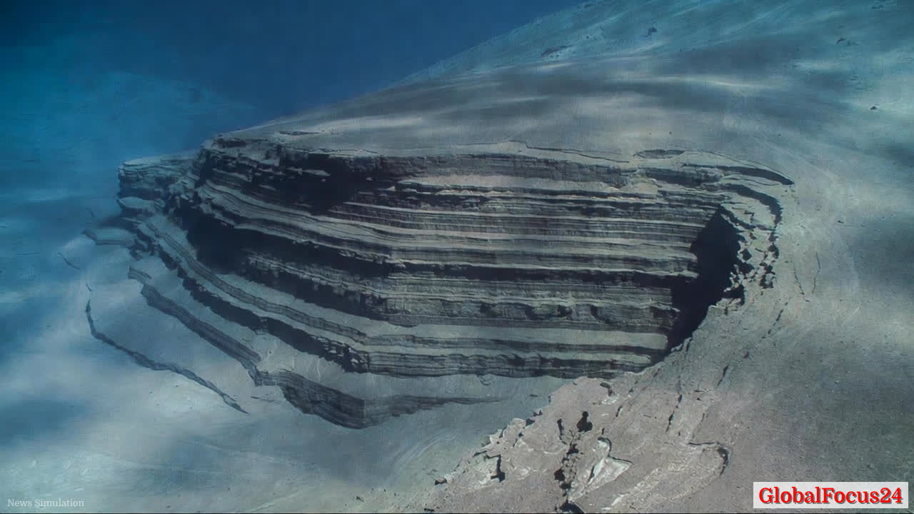
Geological significance: a buoyant mantle layer and its implications
The central finding is a 12-mile-thick layer of rock beneath Bermuda that appears buoyant relative to the surrounding mantle. Scientists describe it as potentially a frozen magma layer or an altered mantle volume with distinctive mineralogy and density properties. This buoyancy could exert a subtle yet persistent upward force, supporting the island’s seafloor elevation and contributing to the relative stability of Bermuda’s topography in a region where sea-level rise and subsidence pressures pose ongoing challenges.
Experts caution that the interpretation rests on complex seismic inversions and modeling. Nevertheless, the data are compelling enough to spur a new line of inquiry into mantle dynamics in mid-ocean ridges and fracture zones. If the layer is indeed a frozen state of prior magmatic activity or an anomalously buoyant mantle domain, it may help explain why Bermuda’s crust remains thicker and stiffer than surrounding sections of the Atlantic plate. Such properties can influence how heat, melt, and deformation propagate through the mantle, ultimately shaping surface features long after volcanic activity has waned.
Economic impact: implications for infrastructure, insurance, and tourism
Beyond the scientific intrigue, Bermuda’s subsurface structure has practical consequences for the territory’s economy. A more precise understanding of seabed geology informs offshore infrastructure planning, which is critical for a maritime economy anchored by shipping, tourism, and financial services. The presence of a buoyant mantle layer could influence seabed stability, seismic risk assessments, and sediment dynamics affecting harbor approaches, submarine cables, and coastal development projects.
Insurance markets, which closely monitor geohazards and seismic risk, may adjust their models as new data refine the probability of ground motion and crustal responses to Atlantic seismicity. While Bermuda’s tectonic environment is not defined by high-magnitude earthquakes compared with larger continental margins, the integration of seismic history with mantle structure offers fresh risk stratification for insurers and developers alike.
The tourism sector, a pillar of Bermuda’s economy, could benefit from enhanced scientific programs that collaborate with universities and research institutions. Public interest in deep-sea geology and Atlantic geology can drive educational outreach, museum exhibits, and citizen-science initiatives that deepen Bermuda’s global profile as a site of scientific discovery. In a broader sense, the discovery stimulates regional science diplomacy by connecting Bermuda with international research networks pursuing mantle studies, oceanography, and geophysics.
Regional comparisons: Bermuda in context with neighboring Atlantic basins
When compared to neighboring Atlantic regions, Bermuda’s new mantle feature appears as a standout in several respects. The Atlantic Ocean’s western margins have long been studied for their dynamic interplay between tectonic plates, hotspot activities, and past subduction events. Bermuda’s elevated seafloor, once linked to a volcanic chain now dormant, contrasts with the relatively flatter seafloor of other mid-Atlantic regions. The newly identified buoyant layer could account for localized crustal thickening and uplift, a feature that may not be universally present across the basin but could explain anomalies observed in other intra-plate regions.
In the Caribbean and Gulf regions, where complex plate interactions generate pronounced seismicity and volcanic histories, deep mantle features have been implicated in shaping crustal architecture and surface expressions. Bermuda’s discovery adds a complementary data point to global models of mantle convection, crustal buoyancy, and the long-term evolution of mid-ocean ridges. It invites a reevaluation of regional geodynamic models, particularly in how deep mantle processes propagate upward to influence island elevation, seafloor topography, and the stability of continental shelves over millions of years.
Scientific methodology: how researchers uncovered the buried layer
The discovery rests on an innovative use of seismic data collected from 396 distant earthquakes. Seismic waves traversing the Atlantic carried signatures that allowed researchers to infer variations in density and composition beneath the seafloor. By analyzing travel times, wave speeds, and attenuation patterns, scientists reconstructed a 12-mile-thick zone with distinct physical properties that set it apart from surrounding mantle rock. Advanced computational models translated these signals into a coherent geologic interpretation: a buoyant layer capable of supporting surface uplift and maintaining Bermuda’s relative elevation.
This approach demonstrates the power of global seismic networks for offshore geophysics. It also showcases how modern data analytics, high-performance computing, and cross-disciplinary collaboration—from mineral physics to plate tectonics to oceanography—can transform indirect observations into tangible geologic insights. The methodology may become a blueprint for future studies of deep mantle structures that influence surface geology in other remote regions.
Public reaction: curiosity, caution, and the sense of discovery
News of Bermuda’s buried giant has sparked public fascination and a renewed sense of wonder about the oceans’ hidden depths. Scientists emphasize that while the discovery is compelling, it represents a single piece of a complex geologic system. Publicly shared simulations and explainer materials help residents and interested readers understand how deep-earth processes shape their coastlines, ecosystems, and livelihoods. Local communities, fishermen, and coastal planners are watching closely as researchers validate findings, refine models, and assess any potential implications for shoreline management, coastal protection, and disaster preparedness.
The broader public’s reaction is guided by the durable human interest in deep time—how events that occurred millions of years ago continue to shape present-day geography. The Bermuda colloquial appeal—its pink sand beaches, turquoise waters, and storied maritime history—now intersects with cutting-edge geophysics, inviting residents and visitors to view the island through a new scientific lens.
Environmental considerations: deep time, climate context, and ocean health
Understanding Bermuda’s subsurface structure intersects with contemporary environmental questions. While the buoyant mantle layer is a deep-earth feature, its existence adds to the narrative of how ocean basins evolve, respond to thermal processes, and interact with sea-level fluctuations driven by climate dynamics. As researchers refine their understanding of mantle properties and crustal buoyancy, they also illuminate how marine ecosystems rely on stable seabed conditions for habitats, nutrient cycling, and sediment transport.
Oceans researchers often emphasize that geological processes interact with ocean chemistry, currents, and biological communities. A deeper appreciation of the mantle’s role in shaping crustal uplift can inform coastal erosion models and shoreline resilience planning, particularly for small island nations dependent on tourism and maritime industries. The discovery thus contributes to a broader, integrative view of how Earth’s interior influences surface environments over long temporal scales.
Technical appendix: what the discovery does—and does not—prove
- The finding identifies a thick, buoyant rock layer beneath Bermuda that plausibly accounts for sustained seafloor elevation. While the data are robust, scientists will pursue additional seismic surveys, drilling, and mineralogical analyses to confirm the layer’s composition and history.
- The interpretation aligns with established concepts of mantle buoyancy and magmatic residue, but it does not rule out alternative explanations such as localized mantle heterogeneity or ancient crust-mantle interactions that could produce similar seismic signatures.
- The work complements existing literature on Pangea’s breakup, mid-Atlantic geodynamics, and intra-plate uplift. It does not imply recent volcanic activity or imminent volcanic resurgence, but it does suggest notable long-term mantle processes that modify crustal behavior.
Implications for future research: questions guiding next steps
Researchers plan to expand seismic coverage across a wider swath of the Atlantic to determine whether similar buoyant mantle domains exist beneath other isolated islands or seamounts. Drilling programs may aim to sample the boundary zones of the buoyant layer to ascertain temperature, composition, and phase transitions that govern its density and behavior. Integrating gravity data, magnetotelluric measurements, and rock physics experiments will further constrain models of mantle dynamics and their surface expressions.
The Bermuda case also invites comparative studies with other archipelagos and oceanic plateaus where crustal buoyancy and elevated seafloor topography persist in seemingly quiescent tectonic settings. By building a catalog of deep mantle features and their surface correlates, scientists can refine predictive models for island formation, subsidence, and resilience in rising seas.
Conclusion: a landmark in Atlantic geophysics with broad reach
The discovery of a 12-mile-thick buoyant rock layer beneath Bermuda marks a watershed in Atlantic geophysics. It bridges deep Earth processes with surface geography, offering a plausible mechanism for Bermuda’s enduring elevation in a region where volcanoes have long since quieted. The finding enriches the historical narrative of Pangea’s breakup, anchors a new chapter in mantle dynamics, and carries practical implications for infrastructure planning, risk assessment, and environmental stewardship in a changing ocean.
As scientists continue to validate and expand upon these results, Bermuda stands at the forefront of a global conversation about how deep Earth structures shape the islands that dot our oceans. The reef-fringed shoreline, the sapphire waters, and the island’s storied past now share a common thread: their ongoing story is written, in part, by a silent giant lurking beneath the Atlantic—an ancient, buoyant layer of rock that has quietly governed Bermuda’s fate for eons and may continue to influence the region for generations to come.